If you are looking for an adventurous trekking experience then, the mountains of Nepal have so much to offer you. Climb the greatest trekking peaks of Nepal to take your trekking to the next level. trekking peak in Nepal Currently, 27 mountain peaks with an altitude between 5,849m to 6,584m have classified as ‘Trekking peak’ by the Nepal Mountaineering Association (NMA). It promotes mountain tourism and issues climbing permits for trekking peaks of Nepal. In 2002, several new trekking peaks were added to the list and divide into two different groups, i.e. Group A and B.
Group A (NMA Expedition Peaks): Basically, Group A includes new trekking peaks. The list includes 12 mountain peaks such as Cholatse, Kyazo Ri, and many more.
Group B (NMA Climbing Peaks): Group B trekking peaks include 15 mountain peaks such as Mera Peak, Kusum Kanguru, and many more. Below, I have listed all the trekking peaks of Nepal based on their region and NMA Group.
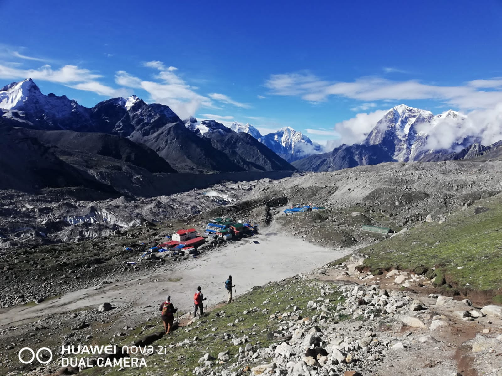
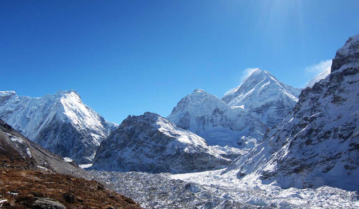
KHUMBU OR EVEREST REGION TREKKING PEAK
The Khumbu or Everest region is the most popular trekking destination in the world. In Nepal, this region offers the most trekking peaks with moderate to high difficulty levels. For a trekking trip in the Khumbu region, you have to fly to Lukla from Kathmandu.
Also, you buy necessary trekking gear and equipment such as climbing boots, an ice axe, gloves, or sleeping bags from Kathmandu. But in case, if you miss out on something you can easily get it from the Namche Bazar as well.
Group A (NMA Expedition Peaks): The Group A trekking peaks located in the Khumbu or Everest region are as follows:
1: Mt. Cholatse (6,440m/21,123ft)
Mt. Cholatse is located between the Khumbu and Gokyo valleys in the Everest region of Nepal. It is also known as Jobo Lhaptshan. Together, you can also see the view of the north and east faces of Cholatse from the route to Mt. Everest base camp and Dughla village. The steep ridges and narrow snow of the magnificent but the Cholatse peak make it highly difficult and challenging. For experienced climbers, it can be a hidden gem. The trek route to the summit of Mt. Cholatse starts from the Lukla to Namche Bazaar. After Namche Bazaar, you have to trek to Pheriche village and all the way up to the summit.
2: Mt. Phari Lapcha (6,273m/20,575ft)
Mt. Phari Lapcha is located near the Gokyo valley and along with the Mahalangur Himalayan range in the Khumbu region. It is also known as Machermo. In 2002, this trekking peak was added to the list of permitted trekking peaks by the NMA. Since then it has been gaining popularity among climbers. This trekking trail starts from the Lukla to Namche Bazaar and from Namche Bazaar to Gokyo. The steep north face of the mountain makes it challenging and technical for climbers. From the summit of Mt. Phari Lapcha, you will witness the most spectacular close-up view of several mountain ranges such as Everest, Lhotse Shar, Lhotse, Amadablam, and Nuptse.
3: Mt. Kyajo Ri (6,186m/20,290ft)
Mt. Kyajo Ri is a classic peak, located in the north of the Namche Bazaar. The stunning view of this classic peak can also be seen from Lungden village, Machermo in the Gokyo valley and, the base of the Renjo La Pass. Trekking to Mt. Kyajo Ri is difficult and challenging enough for experienced climbers to take their trekking experience to the next level. Also, it has a beautiful basecamp in the isolated Kyajo Drangka valley.The long line of Mt. Kyajo Ri’s peak goes all the way to Mt. Cho Oyu on the border of Nepal and Tibet. Moreover, it also separates two valleys, the Thame valley (West) and the Gokyo valley (east).
4: Mt. Nirekha (6,159m/20,201ft)
Mt. Nirekha is a new trekking peak, located near the Tibetan border. It is hidden among the magnificent mountains such as Everest, Cholatse, and Cho Oyu. The climb to this peak is quite straightforward and considered a moderate trekking peak. For which you will need crampons, an ice axe, and ropes for trekking. It is suitable for climbers with modest technical skills.
5: Mt. Ombigaichen (6,340/20,795ft)
Mt. Ombigaichen is also known as Puma Dablam. It is located to the southeast of Mt. Ama Dablam and north of Mingbo la pass. In 2002, trekking to this peak was permitted by the Nepal Mountaineering Association. The trekking starts from the Namche Bazzar to Ama Dablam base camp and then to the summit of Ombigaichen base camp. You will get a rewarding view of several mountain peaks such as Everest, Nuptse, Lhotse, Makalu, Baruntse, Ama Dablam, and many more from the peak of Mt. Ombigaichen.
6: Mt. Abi (6,097m/19,998ft)
Mt. Abi peak refers to the twin peaks of Kangchung Shar and Kanchung Nup. These twin peaks are located at the north of the Gokyo valley.
- Abi-Kangchung Shar (pyramid) (6,103m/20,023ft): The wonderful twin peaks of Kangchung can be easily seen from all the high points around the Gokyo region. The word Kangchung means ‘small mountains’ in Sherpa Language.
The climb from the south side of the peak is quite straightforward up an icefall. The knobby view of the eastern side of the peak is a steep pyramid. However, the north side of the peak is impossible to pass.
- Abi-Kangchung Nup (Cholo) 6,089m: The Kangchung Nup peak has to be climbed from a rock saddle southwest of Surprise Lake. To pass the rock ridge and snow gully, you will need 200m of rope.
After passing the rock ridge and snow gully, you will reach the small summit. From where you can pass the ridge easily in good conditions. Otherwise, You can flip a 200m rope over the gully to drop it down and climb down. The climb to Mt. Abi is adventurous and fairly difficult at the same time. Therefore, it is rarely attempted and only suggested for experienced climbers.
Moreover, you can climb both the peak by purchasing a single permit for Mt. Abi. It is a perfect peak for acclimatizing and practicing ice climbing for those who are deciding to climb higher peaks above 8000m
7: Mt. Lobuche West (6,145m/20,156ft)
The Mt. Lobuche has two different summits i.e. East summit of 6,119 m and a West summit of 6,145m. The west peak of Mt. Lobuche considers an Expedition peak by the Nepal Mountaineering Association. Whereas, the east peak is considered a trekking peak. The long ridge connects both the summit but also there is a sharp gap with a significant distance between them. The west peak is rarely climbed because attempts are usually made from the east.
Group B (NMA Climbing Peaks): The Group B trekking peaks located in the Khumbu or Everest region are as follows:
8: island peak Imja Tse (6,173m/20252ft)
Imja Tse mountain is also famously known as ‘Island Peak’. Which was named by Eric Shipton because it looks like ‘an island in a sea of ice’. It is one of the most popular trekking peaks in the Khumbu region of Nepal. The climb to this peak is fairly tough and challenging full of crevasses. Also, because of insufficient acclimatization and bad weather conditions, many climbers have failed to reach the summit. Therefore, it is necessary to take an acclimatization trip to Lobuche, Kala Pattar, or any other peaks of Chukhung valley. From the Imja Tse peak, you will get a chance to see Everest more closely.
9: Mera Peak (6,476m/21,246ft)
Mera Peak is one of the most popular trekking peaks in the Khumbu or Everest region of Nepal. It has two summits and most of the climbers attempt the easier one. By taking a higher line up to the eastern peak which consists of a steep approx. 20 meters long. It includes more trekking than climbing and is considered one of the dangerous trekking peaks. It is necessary to take an ice axe, crampons, and a fixed rope while trekking. From Lukla, the suggested days for acclimatization are of 12 days. Moreover, over routes may demand more acclimatization period and extensive mountaineering skills.
10: Lobuche East (6,105m/20,029ft)
Lobuche East is located to the southwest of Everest, above the Khumbu Glacier, and the Lobuche village. It is one of the most popular and technical trekking peaks in the Khumbu region. The false summit of Lobuche East requires at least two days of training because of its technical difficulty. As you climb the peak, the difficulty level increases and the path becomes narrower. Also, many Everest groups trek to Lobuje for acclimatization as camp 1 on Everest is of the same altitude.
11: Kongma Tse or Mehra Peak (5,817m/19,084ft)
Kongma Tse is located to the north of Kongma La, above the Khumbu Glacier, and opposite Lobuche village. This peak is among the peaks that form the Long southwest ridge of Nuptse mountain. The summit of Kongma Tse looks like a diamond-shaped glacier from the Gorakshep settlement. It is more accessible from the Bibre, near Dingboche.
12: Kongde Ri or Kwangde (6,187m/20,298ft)
Kongde Ri is a beautiful ridge of summits, located to the southwest of Namche Bazaar, Khumbu region. You will get a stunning view of Kongde Ri waterfalls from the tea-houses or cafes of Namche Bazaar. Kongde Ri is a collective name for several peaks running to the eastern end of the Lumding Himal. The line of peaks that Kongde Ri includes are Nup Kwangde Shar, Kwangde Lho, and Nupla Khang.
13: Kusum Kanguru Peak (6,369m/20,895ft)
Kusum Kanguru is located very close to Lukla and one of the most complex trekking peaks in the Khumbu region. It conquers the southern end of Charpati Himal. Also, the Kusum Kanguru peak separates the Dudh Koshi valley from the upper reaches of Hinku Drangka. There are several new routes that are difficult and require technical skills.
Pokalde (5,794m/19,009ft):
Pokalde is also one of the famous peaks in the Khumbu region. The climbing permit is not required for this peak as it is below 5,800m. It is visible from the trail between Pangboche and Pheriche village. From that trail, you can also see the Nuptse mountain standing right behind the Pokalde which makes it look smaller.
Among the various routes, most climbers prefer to take Kongma la route to climb the North Ridge of Pokalde peak. For the rocky scramble and steep ridge, you will need trekking equipment like an ice axe, crampons, and rope to climb towards the summit. From the summit, you will witness the stunning views stretching over to mountains like Makalu, Ama Dablam, and Pumori.
ROLWALING VALLEY TREKKING PEAK
The Rolwaling valley is located to the east of Kathmandu along the Tibet border. This beautiful valley lies between the Langtang and Everest ranges. From here you will get a scenic view of several mountains like Mt. Gaurishanker, Dorje Lakpa, Yalung Ri, Rolwaling Himal, Chobabhamre, and Pachharmo peak.
The Rolwaling trekking peaks are one of the most challenging and less known among trekkers. Apart from trekking, this valley also offers an opportunity to experience the traditional Tibetan culture and the wilderness of Nepal.
Group A (NMA Expedition Peaks): The Group A trekking peaks located in the Rolwaling valley region are as follows:
14: Chekigo Peak (6,257m / 20,523ft)
Chekigo Peak is located in the Gaurishankar Himal of the Rolwaling valley. The trail of the Great Himalaya has to be followed for this trekking peak. In 2002, the Cheligo peak was permitted for trekking by the NMA. Only a small number of trekkers attempt this summit as it is a less known trekking peak.
Group B (NMA Climbing Peaks): The Group B trekking peaks located in the Rolwaling valley region are as follows:
15: Parcharmo Peak (6,273m/20,580ft)
The Parcharmo peak is located to the south of Tashi Lapcha Pass in the Rolwaling region. It connects the Rolwaling region with the Everest region. The face of the ridges has a crevasse which makes this trek more difficult. For protection, you will need basic equipment like a rope, an ice axe, or screws while trekking to the Parcharmo. You will get the breathtaking scenic views of Gaurishankar, Mlungtse, and other peaks from the summit of the Parcharmo. However, it is one of the least climbing peaks in Nepal as many trekkers are not familiar with this peak.
16: Ramdung Go Peak (5,930m/19,455ft)
Ramdung Go Peak is located to the south of Na village in the wild upper Rolwaling valley region. It is usually attempted from the north and often combined with the Parchermo trek. The route from the North-East flank is quite straightforward. The summit of Ramdung go offers a stunning view of Langtang Gaurishankar, Menlungtse, and Everest.
ANNAPURNA SANCTUARY REGION TREKKING PEAK
The Annapurna region is heaven for all-level trekkers as here you will get a wide range of trails, from a short trek of three days to month-long treks. It is a hub of Nepal’s most famous mountains such as Manaslu, Machhapuchhare, and magnificent Annapurna massif. Most of the trailheads of the Annapurna Sanctuary region are close to Pokhara, one or two hours from Pokhara.
Group B (NMA Climbing Peaks): All the trekking peaks of the Annapurna region falls under the Group B trekking peaks
17: Hiunchuli (6,441m/21,126ft)
Hiunchuli peak is an extension of the Annapurna South, located at the south face of Annapurna South. This is one of the most popular, challenging, and adventurous trekking peaks in the Annapurna region.Moreover, it is also prone to avalanches, rockfall, and problems in finding routes. This peak has to be best tackled in expedition-style as there is no standard route to climb up to the summit. Mostly, trekkers approach it from the Northwest face or the southeast.
18:Singu Chuli (6,501m/21,323ft)
Singu Chuli is also known as Fluted Peak, is located to the west of Ganggapurma mountain in the Annapurna Sanctuary region. It is Nepal’s third-highest trekking peak. Access to this peak is very challenging for which you will require proper Ice climbing equipment and technical skills. Moreover, it is prone to rockfall and landslides. Among various routes, the south ridge is most common and beautiful.
Other peaks in the Annapurna region: Other peaks like Mardi Himal (5,587m/18,325ft) and Tharpu Chuli (5,663m/18,575ft) are also popular among trekkers. The permits are not required for these peaks as they are below 5,800m.
The Ministry of Tourism of Nepal has classified the Thorong (6032m), (Khatung Kang 6484m), and Dhampus Peak (6,012m) as Expedition peak of the Annapurna region.
MANANG REGION TREKKING PEAK
The Manang is located to the north of the Annapurna range in the beautiful Marshyangdi River valley. This region is one of the most beautiful places full of natural beauty among the rest of the trekking region.
Group B (NMA Climbing Peaks): All the trekking peaks of the Annapurna region falls under the Group B trekking peaks
19: Pisang Peak (6,091m/19,987ft)
Pisang Peak is a pyramidal peak located to the north of the Manang valley. Even though it is considered the easiest trekking peak in the Manang region, but it is a good option for trekkers with some solid experience only.The western side of Pisang is challenging because of its hanging glacier. On the other hand, the huge rock slabs at the end of the western ridge make the climb difficult. Insufficient acclimatization and bad weather also conditions affect the success rate.
20: Chulu East (6,200m/20,336ft)
The Chulu East peak lies to the north of the Manang and is often combined with the famous, Classic Annapurna Circuit trek. It is considered the Island peak of the Annapurnas. However, the correct location of the Chulu peaks is confusing as there are many other peaks of Chulu massif close by which are not indicated on the map. Therefore, it is always hard to differentiate both Chulu East and Chulu West.
For this trekking, you should have an alpine experience than Chulu East because of the steep sections, scree slopes, and crossings of fractured glacial terrain. The climb to this peak is quite straightforward and equipment like crampons, ice axes, and ropes are needed. The northeast ridge is the most common route to the summit of Chulu East.
From the top of the summit, you can enjoy the wonderful scenic views of magnificent mountains like Annapurnas II, III, IV, Gagngapurna, Dhaulagiri, Manaslu, Tilicho Peak, and Glacier Dome.
21: Chulu West (6,419m/21,055ft) Chulu Central (6,558m/21,515ft)
Like the Chulu East, the Chulu West combines with the famous Classic Annapurna Circuit trek. Basically, this peak considers as the Mera Peak of the Annapurnas. This peak is higher than the Chulu East peak.To climb this peak no technical climbing experience is required as it not so difficult trek. But the steep loose rock above the base camp may require some fixing of ropes.
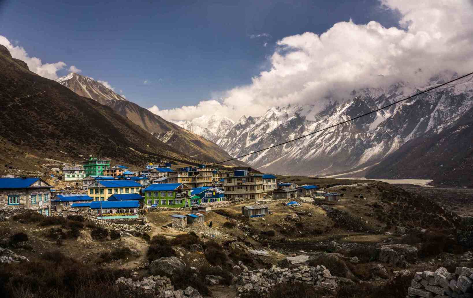
LANGTANG REGION TREKKING PEAK
Langtang region is located 51 km far to the north of the Kathmandu valley. It is a beautiful valley with stunning natural landscapes, authentic culture, and easy access from Kathmandu.
Group A (NMA Expedition Peaks): The Group A trekking peaks located in the Langtang region are as follows:
22: Mt. Yubra Himal (6,035m/19,795ft)
Mt. Yubra Himal, located in the Langtang region is a less climbed peak. It offers wonderful views of the Mountain Ganesh and Rasuwa with the Shishapangma mountain of China in the background.The trekkers take the regular route of the Langtang trek, from Syabru Besi to Kyangjin Gompa and all the way up to the base camp of Mt. Yubra Himal.The route has a steep gully for which you have to scramble to climb and fixed ropes are also required. Despite, its beautiful location and easy trek, and rarely climbed.
23: Mt. Langsisa Ri (6,427m/21,080ft)
Mt. Langsisa Ri is the most popular and technically challenging peak in the Langtang region. In 2002, it introduces as Group A trekking peaks by the Nepal Mountaineering Association. To climb this peak you should have past experience and proper climbing equipment is also needed. Along the route, you will see the Langtang river, stunning mountains, authentic Tamang culture, green fields, yaks, and many more.
Group B (NMA Climbing Peaks): The Group B trekking peaks located in the Langtang region are as follows:
24: Naya Kang or Ganja La Chuli (5,846m/19,180ft)
Naya Kanga is located to the south of a small village, Kyanjin Gompa in the Langtang region. Many different routes are available but the northeast ridge is the regular route to the summit of Naya Kang. However, Climbing this peak is mostly straightforward but also one steep section will be encountered for which ropes are required. You will get a stunning view of the snow-capped mountains in or near Tibet from the summit.
25: Paldor (5,928m/19,450ft)
Paldor is located at the southeast end of the Ganesh Himal range. If you are looking for a lesser crowd trekking peak then Paldor is a good option for you. The route includes glacier crevasses which may level up the difficulty level. After you reach the col, you can climb the straightforward ridge or head around the crevassed back. This peak offers a scenic view of the wonderful mountain peaks such as Langtang Ri, Manaslu, Ganesh, Logsang Karpo, and many more. Also, a spectacular view of Mt. Shishapangma is seen.
Yala Peak (5732m)
Yala Peak is another well-known peak in the Langtang region and does not require a climbing permit. It is an easy trek, located to the northeast of Kyangin Gompa close to the Tibetan border.
MANASLU REGION TREKKING PEAK
The Manaslu region is one of the popular regions for trekking with a wide variety of options. It was officially open for foreign tourists in 1991. Along the trail, you will get breathtaking views of Manaslu mountain and other mountain peaks. If you trek towards the north, you will experience the medieval lifestyle and traditional culture of this region.
Group A (NMA Expedition Peaks): Mt. Larkya Peak is the only trekking peak of the Manaslu region that add to the Group A trekking peak by the NMA.
26: Mt. Larkya Peak (6,249m/19,713ft)
Larkya Peak is an easy and enjoyable trekking peak that lies at the Manaslu Himalayan range. Often trekkers find difficulty in identifying true Larkya Peak. Often, leading up to Sano Larkya Peak (5,807m). Which can easily climb and takes only one day from the base camp, located near Larkya La Pass. Whereas, the climb to real Larkya Peak is long and the slopes are less steep than Sano Larkya Peak. From the summit, you can enjoy an amazing view of mountains like Ganesh Himal, Manaslu, Annapurnas, and many more.
KANCHENJUNGA REGION TREKKING PEAK IN NEPAL
Kanchenjunga region is an extremely remote and rarely visited area of Nepal. It is a conversation area, located in the Himalayas of eastern Nepal. Apart from trekking, you will also get an opportunity to explore the hidden natural beauty, villages, and traditional lifestyle of this region. The Bird species like snow cock, blood pheasant are symbolic of the Kanchenjunga region.
Group A (NMA Expedition Peaks): Mt. Bokta is the only trekking peak of the Kanchenjunga region that adds to the Group A trekking peak by the NMA.
27: Mt. Bokta (6,143m/20,149ft)
Mt. Bokta is a rarely climb trekking peak in the Kanchenjunga region. In 2002, it was classified as a Trekking peak and permitted for climbing. It is one of the challenging trekking peaks that offers breathtaking views of the eastern part of the Himalayan ranges of Nepal. The western ridge of Mt. Bokta is steep and requires technical skills and the eastern ridge is also full of difficulties.
The route from the col to the northern side of the mountain considers the easiest. From a high camp at the col, the route has a steep, snow slope and is prone to rockfall.
Permit Cost for NMA Trekking Peaks in Nepal
permit costs for NMA trekking peaks are as follows:
– $250 for the spring season (March-April-May).
– $125 for the autumn season (September-October-November).
– $70 for the monsoon (June-July-August).
– $70 for the winter season (December-January-February).
The royalty fees for trekking peaks above 6500m for spring, autumn, monsoon, and winter seasons are $400, $200, $100, and $100 respectively. for more information click our website Kingdom Treks.
Also, you have to pay $500 as a garbage deposit to NMA to get a climbing permit. Which will refund as per the provision of NMA. You can easily purchase climbing permits from your trekking agency in one day. For higher trekking peaks (above 7000m) you have to purchase a permit from the Ministry of Tourism or Trekking Agencies Association of Nepal.